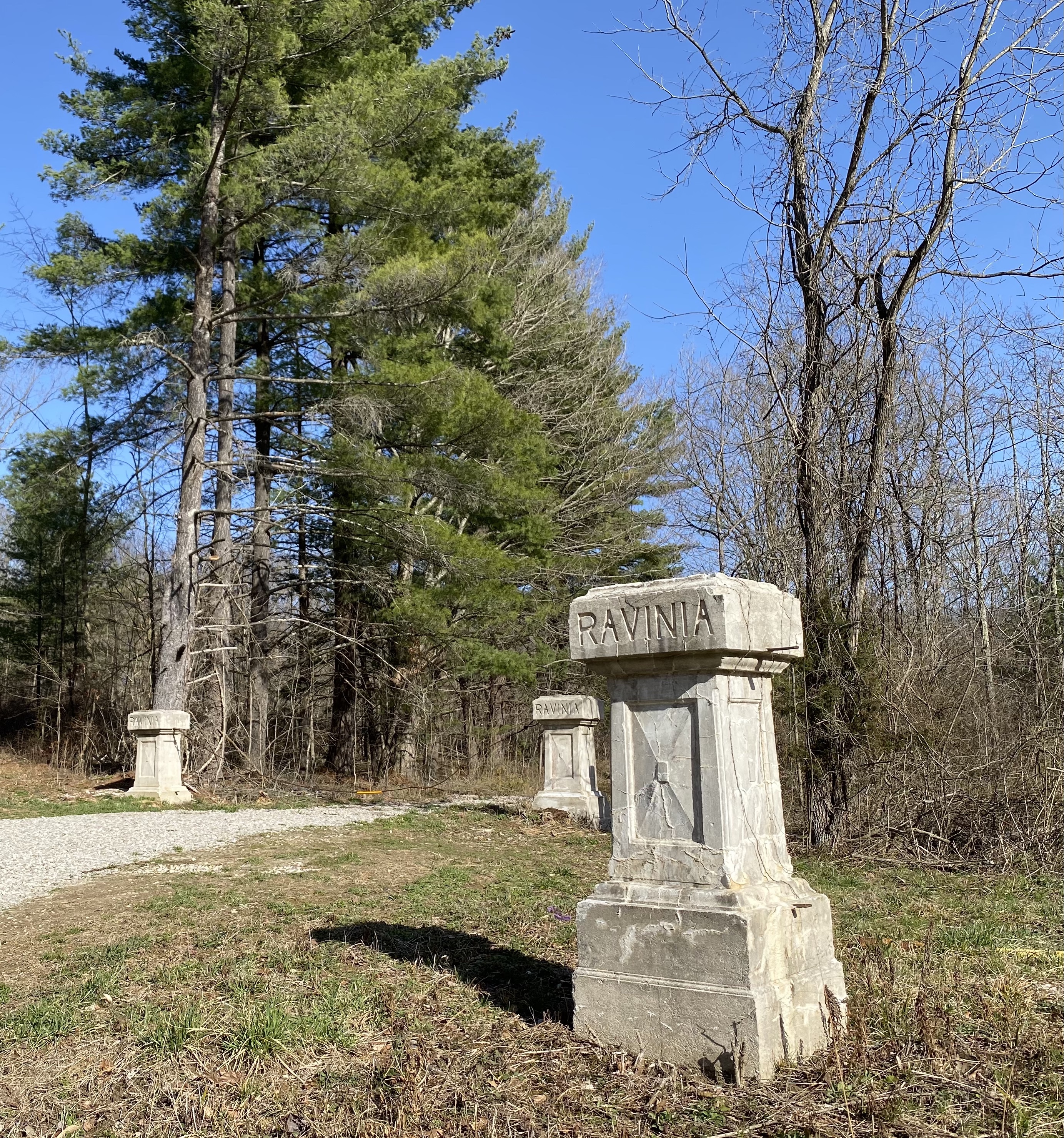
Ravinia Woods is a unit of the Morgan-Monroe State Forest located just 30 miles southwest of Indianapolis. This 1500 acre area of wooded rolling hills and valleys is interspersed with fields, small ponds and several streams. The land was purchased in 2004 from AES/Indianapolis Power and Light and is open to the public for a variety of outdoor activities including wildlife viewing, hiking, and the gathering of wild berries, nuts, and mushrooms.
February isn’t the prettiest month to go hiking in Indiana, but Ravinia is close to home and begged to be explored.
After parking at the trail head I walked across a small field to the tree line. As I stepped into the woods I faced every hikers most annoying “companion”. The infamous “sticker bush”. Oh, the memories of following my dad through the woods as a young boy fantasying that I had a machete to cut these buggers down!
There are no designated hiking trails at Ravinia, so even though this is a small parcel of land, a map of the area and compass are a good idea. Not to mention the knowledge on how to use them.
Before being owned by Indianapolis Power and Light this was farm land. And when you’re hiking through former farm land it seems you almost always come across things like this.
After hiking for a mile or so I came across a small pond that looked like a great place for lunch. I had brought along an old MRE and once I added some water from my hydration pack, lunch was on!
Chicken Fajitas and hot chocolate on a chilly February day. Now that hits the spot!
This little guy showed up while I was eating. Who knew Eastern Box Turtles like chicken fajitas?
When I got back to the trail head there were several Turkey Vultures flying overhead.
I wasn’t sure what they were so excited about until I was on the road. Guess it was their lunch time as well!
Ravinia is a good destination to spend an afternoon exploring the little hills and valleys of south-central Indiana. I’m looking forward to returning in the spring when the trees and wildflowers are in bloom.
The other night I dreamt I was standing underneath a huge sycamore tree surrounded by its fallen leaves. I felt happiness and connection as I took in the wonder of the scene. In the dream, each time I reached down to pick up a leaf, I was reminded of a family member or friend who has passed away.
For the past few weeks I’ve been trying to make sense out of why we suffer and die.My aunt recently passed away from cancer and I have not been able to get my mind around how someone who was still fairly young and very full of life could be dealt such a blow.
In some cases it seems easy to rationalize why.“Well, she was really old.” Or “he smoked like a chimney his whole life”.But in other cases these rationalizations are more of a stretch.So, why?Many of my theist friends might say, “The Lord works in mysterious ways”.My non-theist friends most likely would offer “well it was genetic” or “lifestyle choices” or… some other cause.But these explanations lack something.
I may never know why, but I do understand that life has a season.That death is natural and necessary to make room for new life. In the spring, our blossoms promise boundless possibilities.Then in the summer we open ourselves to the sun and world around us.Finally in the fall we are colored by our experiences and eventually fall to prepare the soil for the next spring. And like sitting under a big sycamore tree, we have all prospered under the shade of love our family and friends have provided us.
As I grow older the number of leaves of fallen loved ones continues to grow about me, but each has touched me with its uniqueness and beauty.This leaf, my maternal grandfather, whose soul was full of grace and here his wife who was so feisty and fun.This leaf, my paternal grandmother, who taught me the importance of family.And here, my paternal grandfather – her husband, from whom I learned to love the land.So many have come and gone, but each so important.My father, who had trouble finding his way, but from whom I learned strength and yes my aunt.Someone who worked hard to provide for her daughter and who knew the wishes and dreams of every niece and nephew.Her “ssssh” would silence a room full of adults so she could hear what the littlest one in the room had to say.Rest now.
The Tippecanoe Battlefield is located in Battleground, Indiana. The Battle of Tippecanoe is considered an important event that many of us in Indiana probably read about in elementary school.
The story goes that white folks in southern Indiana (around Vincennes) were getting nervous about all the Indians gathering in Prophetstown and wanted the territorial governor, William Harrison, to do something about it. If you’re not sure what Prophetstown was, read my earlier blog about Prophetstown State Park.
Harrison waited until Tecumseh, leader of Prophetstown, traveled south to recruit more tribes into his confederation before making his move. While Tecumseh was away his brother Tenskwatawa, “the prophet”, was in charge and Harrison felt he would be easier to deal with.
Harrison’s 1000 troops arrived at present day Battleground on a cold November day and prepared to meet with the Prophet the next day. Harrison had an uneasy feeling about what might happen, so he instructed his troops to sleep in their uniforms and have their guns at the ready. Sure enough, around 4 in the morning, the Prophet’s men attacked and a fierce battle waged for several hours. Before the battle began the Prophet stood on a large rock near where the soldiers slept and told his men that the bullets of the white soldiers would “fall off them like dust” and that they would win. Well, you can imagine how that turned out… Many men were killed on both sides, but Harrison’s troops eventually won the day.
The next day Harrison sent a small group of men to inspect Prophetstown, but everyone had fled during the night and the town was deserted. The Army burned down Prophetstown and returned home.
The park today consists primarily of a cemetery where the US soldiers killed during the battle are buried, a few small hiking trails and a museum. In 1911 a monument similar to the Washington monument was erected to commemorate the US soldiers. At some point a large outdoor swimming pool was built on the site. What a great marketing idea!! “Come swim with the dead at Battleground Indiana!”
This is really a small town/urban park, so the trails are small and none are much more than a mile in length. One of the trails leads to the rock that the Prophet stood on when he cast his spell, which is pretty cool.
There is also a small museum onsite with a lot of the usual museum “stuff”: Bones, deer skins, period costumes, old maps, and memorabilia from the 1976 republican convention. Yes, that’s right, someone has donated an entire ROOM full of schlock from the Gerald Ford/Bob Dole 1976 ticket to the museum. After visiting many insightful areas of the museum that really get you thinking about how our country was created, you step into a room filled with so much red, polyester and corny slogans that you’ll be trippin’ like one of the castaways on the island in LOST. “Ben made me wear this robin’s egg blue leisure suit. He said, ‘The Peanut farmer must never be president.’ The Peanut farmer must never be president’. “
I enjoyed the museum and found it to have quite a bit of useful information, even though, as a city/county supported facility, it probably doesn’t get a lot of funding. Having siad that, I think it does need to be “updated” a little. On more than one occasion in one of the exhibits I heard the narrator refer to “the savage Indian hordes”. I don’t think the former residents of Prophetstown would be referred to like that today.
The Tippecanoe Battlefield Park is a good place to visit and spend an hour or two learning about early Indiana history. Who knows, you might even see Bob Dole in the swimming pool. Ask him to leave the ink pen at home though.
Reposted from July, 2007. Note that the trail no longer follows this exact route.
The Chimney Tops trail is probably one of the most popular trails in the Smokies, but don’t let that keep you from hiking it. Most of the cars you see in the parking lot are for people playing in the creeks around the trailhead. Once you cross the second bridge, and start the trail in earnest, the crowds drop off quite a bit.
The trail is pretty straight forward. Hike 2 miles up, up, up and be rewarded with a great view at the summit. I first did this trail in 1995. I had just turned 31 and this two mile little hike seemed like a piece of cake back then. Now, 12 years later I’m 43, have 3 kids, and I’m carrying an additional 25 pounds or so around with me. This time it was much more of a challenge, but that made reaching the summit all the sweeter.
We guessed it would take us two hours or so to hike the 2 miles up and back, so my wife and our two younger sons explored around the creeks, looking for wild flowers and other interesting things, while my oldest son accompanied me on the hike.
The trail is very pretty at the bottom, as you cross the boulder strewn creeks on well maintained bridges. After the 2nd bridge though, the trail turns and with one look you know that things are about to get a lot more interesting.
From that point on, you hike up at something like a 40 degree or better incline, until you reach the summit. I hate to admit it, but I had to stop at several points on the way up to catch my breath. This is not something I had to do in 1995 and was a wake-up call for me. If I want to be doing hikes like this in another 12 years, I need to get in better shape. Hiking outdoors is my passion and I am in no way ready to start conceding that I just can’t do certain trails any longer. So, tune in around 2019 to see how I’m doing!!
There isn’t a lot to see on the way up. The trail is steep and in some places it can be muddy and slippery. You do see plenty of Yellow Buckeye trees, the Eastern Hemlock ( a personal favorite of mine) and the ever present Rhododendron.
Once you reach the summit the trail levels out and after you scramble over some large tree roots and rock outcroppings you find yourself on a narrow trail overlooking the park. Behind you stands the bare metamorphic slate that comprises the Chimney Tops. The Appalachian Mountains are some of the oldest mountains in the world, so the slate you are touching is approximately 600 million years old. Kind of humbling. That’s a lot older than my oldest, holiest pair of socks!
After reaching the summit I was tired, but also exhilarated. I felt like I had really accomplished something. That is until I saw a teen-age boy making his way back down. He was wearing a Hollister T-shirt and a pair of Crocs (shoes I’m still not sure men should be wearing) and looked like he hadn’t even broken a sweat. He gave a lackadaisical yawn and started his way back down.
We scrambled up the rock face as much as we dared. This is a little risky, so be careful if you attempt it. The climb is steep and the rock is pretty sharp. It would be easy to fall and cut yourself badly. Also, stay away from the shafts. The main shaft is big enough to fall into.
After taking in the view for awhile and catching our breath, we took one last look and started our descent. We half jogged all the way down and made great time getting back to the trailhead.
At the very bottom of the trail I slipped and fell in front of another dad and his young son. All that time practicing Judo over the years paid off, as I did a pretty decent forward roll (Ukemi in Japanese) and came up into a standing position. Everyone was staring at me, so of course I had to say, “That’s how I roll.”
The elevation of the Chimney Tops is said to be 4800 feet. The elevation change for the hiker starting out at the trailhead is approximately 1345 feet. This is a tough, but rewarding trail. So get out there. Take a hike!
As the only designated wilderness area in the state of Indiana, the Deam Wilderness holds a special place in the hearts of all Hoosiers who like their nature experience just a little on the wild side. It has been at least 15 years since I last hiked the Peninsula Trail. The trail and my memory of it have changed just a little since then.
The trail begins at the Grubb Ridge parking area and follows the John Grubb Ridge trail for the first 2.2 miles. It then branches off onto the Peninsula trail, jutting out into Lake Monroe for another 2.6 miles.
When I hiked this trail in the mid 90s I remember the spot where the trail branches off as being unmarked and in the middle of a field of tall grass. That time it was July and the cicadas were making a “thucka-thucka-thucka” sound in the grass that sounds just like a rattlesnake ready to strike. Wearing shorts and tennis shoes I’ll admit I walked really quickly through that grass muttering to myself “it’s just cicadas, it’s just cicadas.” But 15 years later the experience was much less dramatic. For one thing, it was February, and for another the trail seems to split in a different place now. Gone is the tall grass and in its place is just a well cleared trail. Heck, it’s even marked. So no “thucka-thucka-thucka” sounds either as I calmly went on my way.
Much of the trail is shared with horses so you can expect sections of it to be rutted out at times, and depending on the time of year, muddy.
As you start hiking out into the Peninsula you will have several opportunities to gaze through the trees and see the lake below. This is especially nice in the fall and winter when the leaves have fallen.
Parts of the trail are moderately rugged with some decent inclines. As you make your way out you will lose 300 or 400 feet in elevation. Of course, you gain that back on your return trip. I would NEVER condone carving into trees, but I came across this on the trail. I didn’t feel that way when I first read it, but 2 miles later and I was in total agreement.
After approximately an hour and forty five minutes I neared the trail’s end and was greeted with a view of Lake Monroe. This is a beautiful view no matter what time of year it is and after hiking for almost 5 miles is also a very welcome sight!
There are many campsites right on the shoreline. Throw up your tent and stay awhile. You’re sure to have a beautiful sunset and maybe even hear coyotes in the distance as you drift off to sleep.
The Peninsula Trail is a wonderful hike in a very special part of Indiana. Throw on your old hiking boots and check it out. You’ll be glad you did.
Going white water rafting has been a dream of mine for at least 20 years. So, to celebrate my 43rd birthday, (Yikes, I’ll be middle age in another 10 years or so!), I finally realized that dream.
17 years ago, my blushing bride and I took our honeymoon in the beautiful Smoky Mountains. On our last day we drove over to Bryson City, North Carolina, and watched all the happy people rafting on the Nantahala River , I was really envious, but all the companies had sent out their last buses for the day, so all I could do was buy a T-shirt and keep it in mind as something to eventually do.
17 years later we decided to take a family vacation in the Smokies and you better believe that I remembered the Nantahala! As there are many, many rafting companies on the river I did a lot of research of the different ones and settled on the Carolina Outfitters. They seemed to offer the best overall “bang for the buck” in pricing and service.
Word to the wise: if you’re staying in Gatlinburg or Pigeon Forge allow at least 2 ½ hours to get to the Nantahala. It can be done in 2, but you’ll be pushing it.
The Nantahala is dam fed and as the water comes from the bottom of a 500 foot lake it is consistently between 45 and 50 degrees Fahrenheit. On the day of my trip it was cold and rainy and was a brisk 65 degrees outside. To say we froze our butts off would be an understatement.
Accompanying me on my trip was my oldest son, born 2 years after we were married. As both of us are cool and tough guys we decided to pass on the big rafts that hold 10 people or more and rented a two person raft. He is a boy scout with a lot of experience canoing on flat water, and I’ve been in a boat or two myself over the years, so we thought we’d be good to go. Course all of our experience is in Indiana and that just doesn’t compare to the white water in North Carolina.
We were greeted by the super friendly staff at Carolina Outfitters and talked to the various guides while we waited for our bus to depart. I was a little surprised at one point as I heard Evelyn, one of the guides, (I think that was her name) talking loudly in a foreign language. One of the guys answered her and so I had to ask what language they were speaking. “Polish”, he said.
“I knew they talked funny in the south, but I didn’t know they talked THAT funny”, I jokingly said.
We rode the bus down to the put in and all was well until the moment we put our raft in the water. Then I realized that my son and I just could not properly coordinate our paddling in the raft and as we headed over the first rapid backwards, a class II+ called Patton’s run, I wondered if we had made the right decision to do this on our own.
I eventually realized though that our raft was quite sturdy and as long as we tucked our legs in under the raft and went with the flow, we did just fine going down the rapids backwards, sideways, and even a few facing forward. Not to be corny, but afterwards the whole thing really struck me as a metaphor for life. Going with the flow.That no matter how much you try to exert control over life, sometimes you just have to “go with the flow”.
Due to all the rain and cold it was very foggy on the river. We could barely see 10 feet in front of us. This was cool except that it made scouting the rapids very difficult as we could only see them just before we hit them. The section of the river that you raft on is approximately 8 miles long and takes between 2 and 3 hours to complete.
We eventually worked out most of the kinks in our paddling and enjoyed a great trip down the river. During the instruction we were given before we left the outfitters we were told that we didn’t want to miss our put out after the class III Nantahala Falls rapid, because after that was a class V rapid and they wouldn’t be able to get to us. Well, we went through the Nantahala Falls rapid pretty easily and started paddling towards the put out, but the draw of the next rapid was too strong and as I paddled with all my might, I realized that we were going over the class V…backwards. Luckily, we came through unscathed, but knew we had to get out of there. I saw a put out on the far side of the river and we made for it with all we had. We got out and carried our raft across a bridge to the waiting buses.
The trip and staff at Carolina Outfitters was great and I can’t think of any other way I would rather have spent my birthday. So, get out there and raft the Nantahala, but remember, rafting and banjo music don’t mix!